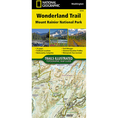
1014 Mount Rainier National Park - Wonderland Trail Washington
The Wonderland Trail encircles Mount Rainier and was completed in 1915 by volunteers and designated a National Recreation Trail in 1981. The Wonder...
View full detailsThe Wonderland Trail encircles Mount Rainier and was completed in 1915 by volunteers and designated a National Recreation Trail in 1981. The Wonder...
View full detailsNational Geographic's Trails Illustrated map of Colorado’s Holy Cross and Eagles Nest Wilderness is a two-sided, waterproof map designed to meet th...
View full detailsThe National Geographic -Trails Illustrated folded map is your essential guide for outdoor exploration in Colorado's Pikes Peak/Canon City area. T...
View full detailsThe South San Juan/Del Norte Trails Illustrated map is the most comprehensive recreational map for one of Colorado's most secluded wilderness areas...
View full detailsThis Trails Illustrated topographic map is the most comprehensive recreational map for Tennessee's Cherokee National Forest, Southern Districts, Te...
View full detailsBig South Fork National River & Recreation Area straddles southern Kentucky and northern Tennessee. This is the most comprehensive guide for hi...
View full detailsThe National Geographic's- Trails Illustrated folded map is your essential guide for outdoor exploration in Alaska's Prince William Sound - West a...
View full detailsTrails Illustrated folded topo map - National Park Series - shows hiking trails and recreational features, printed on waterproof, tear-resistant pl...
View full detailsThe National Geographic's- Trails Illustrated folded map is your essential guide for outdoor exploration in Alaska's Katmai National Park and Pres...
View full detailsThis is the most comprehensive recreational guide for hiking, boating, paddling, biking, fishing, exploring, camping, and sightseeing in this uniqu...
View full detailsThis Trails Illustrated topographic map is the most comprehensive recreational map for the Yuba and American Rivers area of the Tahoe National Fore...
View full detailsThis Trails Illustrated topographic map is the most comprehensive recreational map for Washington's Mount Rainier National Park. Within the park, t...
View full detailsWaterton Lakes NP includes Waterton Park, Upper and Middle Waterton Lakes, The Border Ranges, Akamina Kishinena Provincial Park, Blood Timber Reser...
View full detailsThe National Geographic - Trails Illustrated folded map is your essential guide for outdoor exploration in Bandelier National Monument. The brilli...
View full detailsThe Indian Peaks/Gold Hill Trails Illustrated map is the most comprehensive recreational map for the southern gateway forests and wilderness areas ...
View full detailsThe National Geographic - Trails Illustrated folded map is your essential guide for outdoor exploration in Zion National Park. The brilliantly ill...
View full detailsThis map includes the entire national park area, with detailed trails and topographic information. Also covered are portions of Grand Staircase - E...
View full detailsThis Trails Illustrated topographic map is the most comprehensive recreational map for California's Sequoia and Kings Canyon National Parks. Some h...
View full detailsTrails Illustrated folded topo map - National Park Series - shows hiking trails and recreational features, printed on waterproof, tear-resistant pl...
View full detailsThe Poudre River/Cameron Pass Trails Illustrated map is the most comprehensive recreational map for this beautiful area surrounding the northern po...
View full detailsThe National Geographic -Trails Illustrated folded map is your essential guide for outdoor exploration in Colorado's Red Feather Lakes/Glendevey a...
View full detailsThe Crested Butte/Pearl Pass Trails Illustrated map is the most comprehensive recreational map for this beautiful area of Colorado. Coverage includ...
View full detailsCoverage of the Old Faithful area of Yellowstone National Park includes Heart Lake BMA, Pitchstone Plateau, Bechler Ranger Station, South Entrance,...
View full detailsCoverage includes: Gunnison and San Isabel National Forests; Collegiate Peaks Wilderness; the cities of Buena Vista, Princeton, Rockdale and Winfie...
View full details