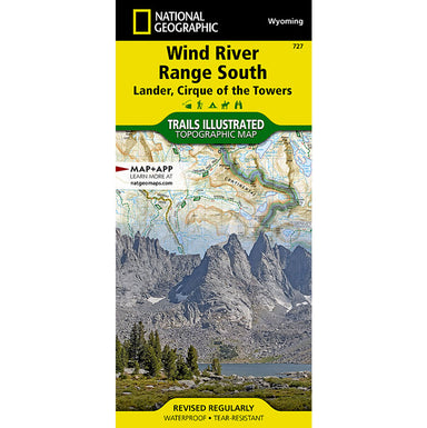
National Geographic 727 Wind River Range South Map
• Waterproof • Tear-Resistant • Topographic Map The Wind River Range of northwest Wyoming encompasses an area of more than 3,500 square miles. Loca...
View full details• Waterproof • Tear-Resistant • Topographic Map The Wind River Range of northwest Wyoming encompasses an area of more than 3,500 square miles. Loca...
View full detailsTrails Illustrated folded topo map - Specialty Series - shows hiking trails and recreational features, printed on waterproof, tear-resistant plasti...
View full details• Waterproof • Tear-Resistant • Topographic Map The largest alpine lake in North America, Lake Tahoe straddles the border of California and Nevada....
View full details• Waterproof • Tear-Resistant • Travel Map National Geographic's Texas Hill Country Destination Map strikes the perfect balance between map and g...
View full detailsThe National Geographic - Trails Illustrated folded map is your essential guide for outdoor exploration in Lake Mead National Recreation Area. The...
View full details• Waterproof • Tear-Resistant • Topographic Map Colorado's Roaring Fork Valley is a popular destination for year-round outdoor recreation from Gold...
View full details• Waterproof • Tear-Resistant • Topographic Map National Geographic's Map Guide of the John Muir Trail is an indispensable tool for navigating one ...
View full details• Waterproof • Tear-Resistant • Topographic Map Mount Whitney is universally famous as the highest peak in the contiguous United States, as well as...
View full details• Waterproof • Tear-Resistant • Topographic Map Conceived in 1978 and completed in 2001, the 175-mile Tahoe Rim Trail (TRT) circumnavigates the bea...
View full details• Waterproof • Tear-Resistant • Topographic Map Colorado has the highest mean elevation of any state in the United States. It's home to 58 mountain...
View full detailsThis map includes: wilderness areas; Rapidan Wildlife Management Area; Overall Run Waterfall; Whiteoak Canyon Waterfall; Cedar Run Waterfall; Rose ...
View full detailsTrails Illustrated folded topo map - National Park Series - shows hiking trails and recreational features, printed on waterproof, tear-resistant pl...
View full detailsCoverage of the Yellowstone Lake area of Yellowstone National Park includes: Pelican Valley BMA; Clear Creek BMA; Lake Spawn Area; North Absaroka W...
View full detailsJoshua Tree National Park is a fascinating land of surreal geologic features shaped by strong winds, unpredictable torrents of rain, and climatic e...
View full details• Waterproof • Tear-Resistant • Topographic Map Conceived in 1978 and completed in 2001, the 175-mile Tahoe Rim Trail (TRT) circumnavigates the bea...
View full details• Waterproof • Tear-Resistant • Travel Map Created in cooperation with Instituto Geografico Nacional, National Geographic's Costa Rica Adventure ...
View full details• Waterproof • Tear-Resistant • Topographic Map Towering over the Rocky Mountains stands the 14,259 foot high Longs Peak. National Geographic's Tra...
View full detailsFish Lake is a high alpine lake nestled in a deep valley at the southern edge of the Wasatch Front. Manti is a small town that serves as a convient...
View full details• Waterproof • Tear-Resistant • Topographic Map Cedar City is the headquarters of the Dixie National Forest which is a two-million-acre, 170-mile s...
View full details• Waterproof • Tear-Resistant • Topographic Map National Geographic's Trails Illustrated map of Rand and Stillwater Pass was designed for outdoor e...
View full details• Waterproof • Tear-Resistant • Topographic Map Colorado's Roaring Fork Valley is a popular destination for year-round outdoor recreation from Gold...
View full details• Waterproof • Tear-Resistant • Travel Map National Geographic's Northern Spain Adventure Map is designed to meet the unique needs of adventure t...
View full details• Waterproof • Tear-Resistant • Topographic Map Colorado is renowned for its outdoor recreational opportunities. One of these pastimes is, of cours...
View full detailsThe Wonderland Trail encircles Mount Rainier and was completed in 1915 by volunteers and designated a National Recreation Trail in 1981. The Wonder...
View full details